Since Sunday, the Lone Star State has been inundated with rain, with rain gauges close to Trinity recording 6 to 9 inches and Groveton receiving almost 11 inches following a series of storms that ended the weekend and began the workweek.
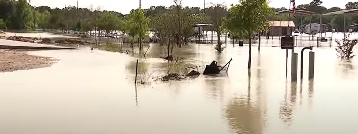
Parts of Southeast Texas continue to be extremely at risk of flooding due to the region’s ongoing heavy rainfall and extreme weather, which causes rivers and streams to overflow their banks and flood neighborhoods.
Tuesday and Wednesday saw further precipitation fall in many of the same places, further contributing to the historic rainfall totals. On Wednesday, Waterwood received over 10 inches of rain, and Sebastopol received 9 inches not too far behind. Numerous other locations, such as Loma, Freestone, and Hunstville, received more than half a foot of rain.
Tens of millions of people are at risk of extreme rainfall on Thursday, with a Level 2 out of 4 forecast, according to NOAA’s Weather Prediction Center. This includes individuals in Texas and Wisconsin.
However, forecasters have upgraded the possibility of excessive rainfall that might cause flooding to a Level 3 out of 4, or Moderate Risk, due to the higher rain that is expected in Southeast Texas.
Flooding is still a big worry because of the severely saturated soils in parts of East and Southeast Texas and the extra rain and storms that forecasters anticipate on Thursday.
It’s a major concern because that same area is currently being pummeled, Merwin added. The Flood Watches are in effect as a result. Not only is the threat of flash floods due to the amount of precipitation falling from the sky, but river flooding is another factor that is seeping into the system.
This is because of the rain that has already poured and is moving downstream, eventually ending up in the Gulf of Mexico, as well as the extra rain and severe weather that is predicted for Thursday.
Waco, Lufkin, Huntsville, and Houston are a few of the Texas cities under flood watch. Cities in North Texas, including Wichita Falls, are under a flood watch. Additionally, a sizable chunk of Shreveport, Alexandria, Lake Charles, and northern and western Louisiana are also on alert.
Several Texas municipalities, including Waco, Centerville, and Woodville, were under multiple flash flood warnings on Thursday morning. Within a few hours, the National Weather Service reported that many inches of rain had fallen, and throughout the morning hours, up to a half-foot of rain may still fall.
The NWS issued a warning that hundreds of low water crossings in mountainous terrain could be hazardous during periods of intense rain. Never try to cross a flooded road. Look for a different path.
For the remainder of the week, much of East Texas may anticipate another one to two inches of rain. However, a sizable portion of Southeast Texas will experience far higher rainfall totals.
From Centerville and Lufkin southward into Conroe and locations north of Houston, there could be a fall of two to three inches. Spurger is one of the places in that area that might receive an extra three to five inches of rain before the rainfall leaves the area.